Fuels reduction along popular Tahoe road wraps up, a step forward in evacuation safety
December 31st, 2025Katelyn Welsh, Tahoe Daily Tribune
TAHOE CITY, Calif. – Crews have recently completed a fuels reduction project along River Road. The Truckee to Tahoe City portion of Highway 89 is a main artery not only to and from Tahoe, but also to both Palisades Tahoe bases and the greater Olympic Valley area, not to mention its namesake river access.
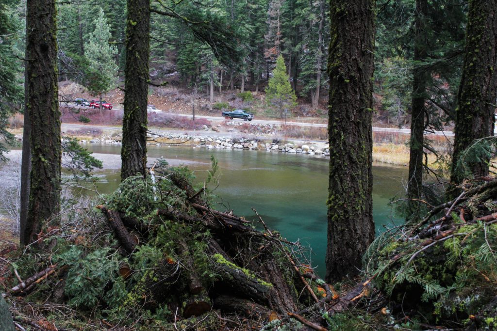
The significant and scenic corridor is also a major evacuation route.
Such corridors into and out of the Tahoe Basin have been on the minds of regional fire leaders. Released in February, the Community Wildfire Protection Plan, a collaborative and comprehensive guide for mitigating wildfire impacts in the Tahoe Basin, prioritizes hardening evacuation routes.
That’s exactly what North Tahoe Fire Protection District’s 88.7 acre River Road Fuels Reduction Project does, which started at the end of September.
“I get a manifest forest health to best protect the community,” NTFPD’s forest fuels manager, April Shackelford said.
As one of the biggest projects Shackelford has led to date, the hand thinning and piling project follows the west side of the river from Lake Tahoe at 64-Acres Park to a location roughly a mile south of River Ranch Lodge.
Modeling revealed the highway-adjacent zone as the highest-priority treatment area for travel safety and property protection within the fire district’s boundaries.
“If we had a lightning strike or ember cast in here on a hot, windy day ” Shackelford explained, “the fire would create a significant threat to the evacuation route and life safety.”
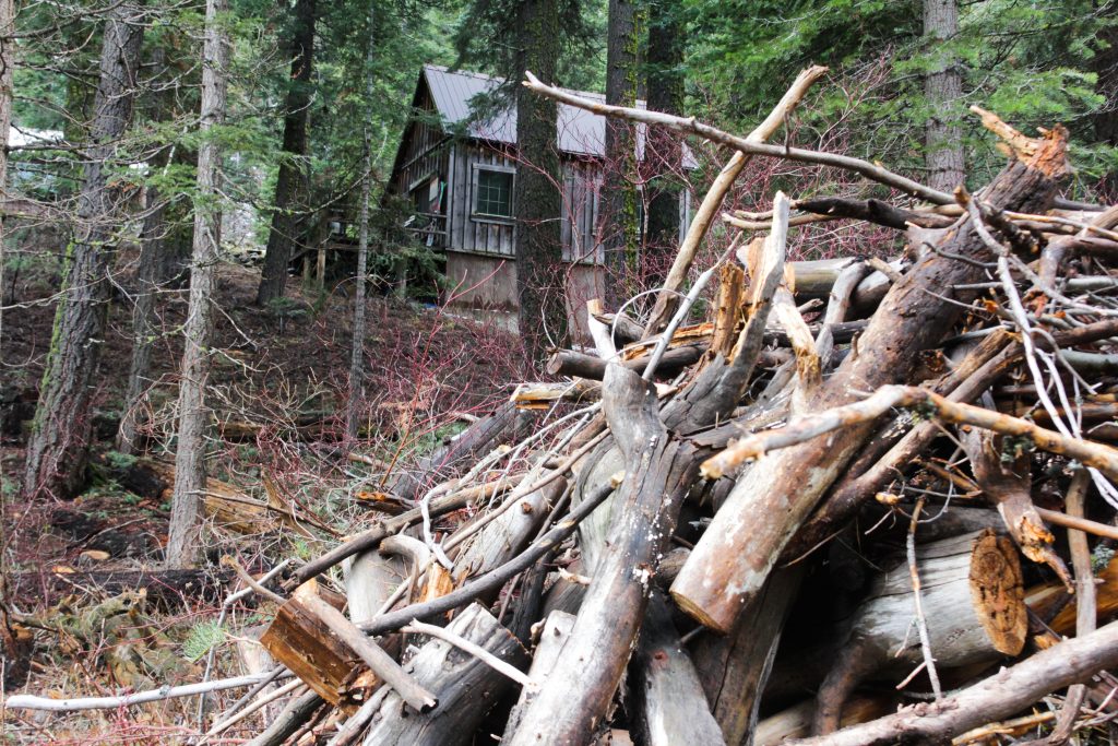
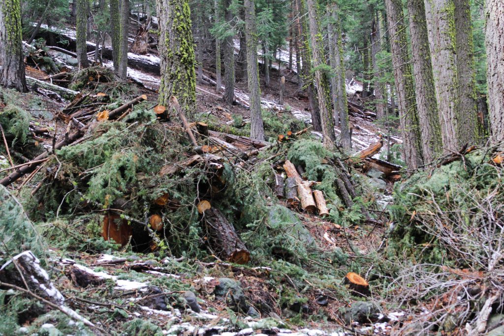
Sierra Nevada Forest Forestry Service, LLC, which the district contracted to do the work, piled dead and downed woody material, eliminated ladder fuels, and removed subdominant trees and excess vegetation.
The mitigation has thinned the dense overgrown forest into a forest resembling the past, once maintained by regular fire intervals.
The project is divided among 69.8 acres of federal land owned by the US Forest Service, 8.3 acres of state land owned by the California Tahoe Conservancy, as well as 10.6 acres of private land owned by five property owners.
“As a local fire district, part of the puzzle is working with private property owners to have fuels reduction as well,” Shackelford said, explaining that working across property ownership is critical in community protection. “So a lot of my charge is lumping in private properties and working across ownership types to connect previous treatments with the treatments we’re doing, and planned future treatments.”
Grant funding from the Truckee Tahoe Airport District made this project possible across federal, state and private property.
In addition to buffering the highway, the project also provides forest, wildlife, and watershed health benefits.
When excessive vegetation grows, water becomes limited, causing vegetation to die back, which can lead to big dominant trees to die as well. “And we certainly saw that with this project” Shackelford said. While most of this excess vegetation was cut and piled with this project, some of the largest dead trees were left as wildlife habitat to promote the forest ecosystem.
Excess vegetation also draws water, in this location, from the Truckee River.
“In watershed management, it has been shown that you get a notable increase in the amount of water in the creek after forest thinning,” Shackelford said, spelling benefits for the river.
By partnering with the Forest Service, the project also had a team from the Placer Resource Conservation District out to eradicate invasive species, adding to the well-rounded benefits.
The stacked piles will burn after remaining on the land to cure for 1-3 years. The district plans on maintaining the treated area in the future, potentially with understory burns.
Although this significantly improves the River Road corridor, there is still work to do.
Future projects will target fuel reduction along the bike path and power line corridor in the coming years.